West Seattle, Washington
22 Sunday
The new-era City Council‘s first committee meeting happened this past week, when the Transportation Committee – chaired by District 1 Councilmember Rob Saka – convened on Tuesday morning. Before the meeting moved into public comment and presentations, Saka said his focuses will be on “preserving and maintaining our infrastructure, with a heavy focus on bridges and streets, in hopes, he said, no other community has to go through anything like the 2 1/2-year West Seattle Bridge closure. He said his other priorities will be the “safety and comfort of pedestrians,” improved transit-rider experience, climate-related issues (particularly increased electrification of transportation), equity, and the size/scope of the next transportation-funding measure.
Of the two introductory presentations made by SDOT, the one of widest interest was an explanation of the department itself, led by director Greg Spotts, who noted he’s had the job for 17 months now. Spotts said he’d done some reorganizing of SDOT management to better handle priorities. For example, toward Saka’s top priority, Spotts said Elizabeth Sheldon serves as chief infrastructure engineer. Venu Nemani, previously chief traffic engineer, is chief transportation safety officer. Shortly after arriving, Spotts noted, he’d ordered a “top to bottom” review of Vision Zero – in light of the fact that traffic deaths and serious injuries were not declining – and he said there’ll be an implementation plan in the next several months. (As an aside, he said he does not own a car.) He talked about the Seattle Transportation Plan, pulling together many separate predecessors (bicycle plan, freight plan, transit plan, etc.), and said upcoming documents will include a Bridge Asset Management Plan. He briefly ran through some of what is on SDOT’s schedule for the year ahead, including bridge seismic upgrades (in West Seattle that includes the Delridge/Oregon overpass and the Admiral Way bridges over Fairmount Ravine).
His presentation included many stats – from 500 cameras in the traffic-control center downtown, to 14,000 openings per year for the city-owned movable bridges, including the West Seattle low bridge. (Spotts noted that shipments requiring those openings include a lot of food destined for Alaska.) Another stat of interest: There are about half a million street parking spaces in the city, but “we only charge for about 12,000 of them.”
One more note of West Seattle interest – Spotts briefly mentioned the city’s involvement with Sound Transit for the West Seattle and Ballard extensions. That group, he said, also reports to Sheldon, the chief infrastructure engineer.
The presentation also touched on the SDOT budget and the “83 sources of funding” that feed into it, “more than most city departments.”
Eventually Saka brought it back to his interest in pothole-filling as a symbol of what the city can do for its residents; not only does he want to be “the king of potholes,” but he also declared his fellow committee members “pothole royalty” too, though in a more serious vein, he suggested the “underlying causes” of potholes should be examined and addressed too.
You can watch the meeting in the Seattle Channel video above, and see the “introduction to SDOT” slides here. In addition to chairing the Transportation Committee, Councilmember Saka is vice chair of the Public Safety Committee, which will meet at 9:30 am Tuesday (February 13) for the first time this year; as we previously noted, all three of the city’s public-safety chiefs (CARE’s Amy Smith, SFD’s Harold Scoggins, SPD’s Adrian Diaz) are on the agenda to provide overviews of their departments.
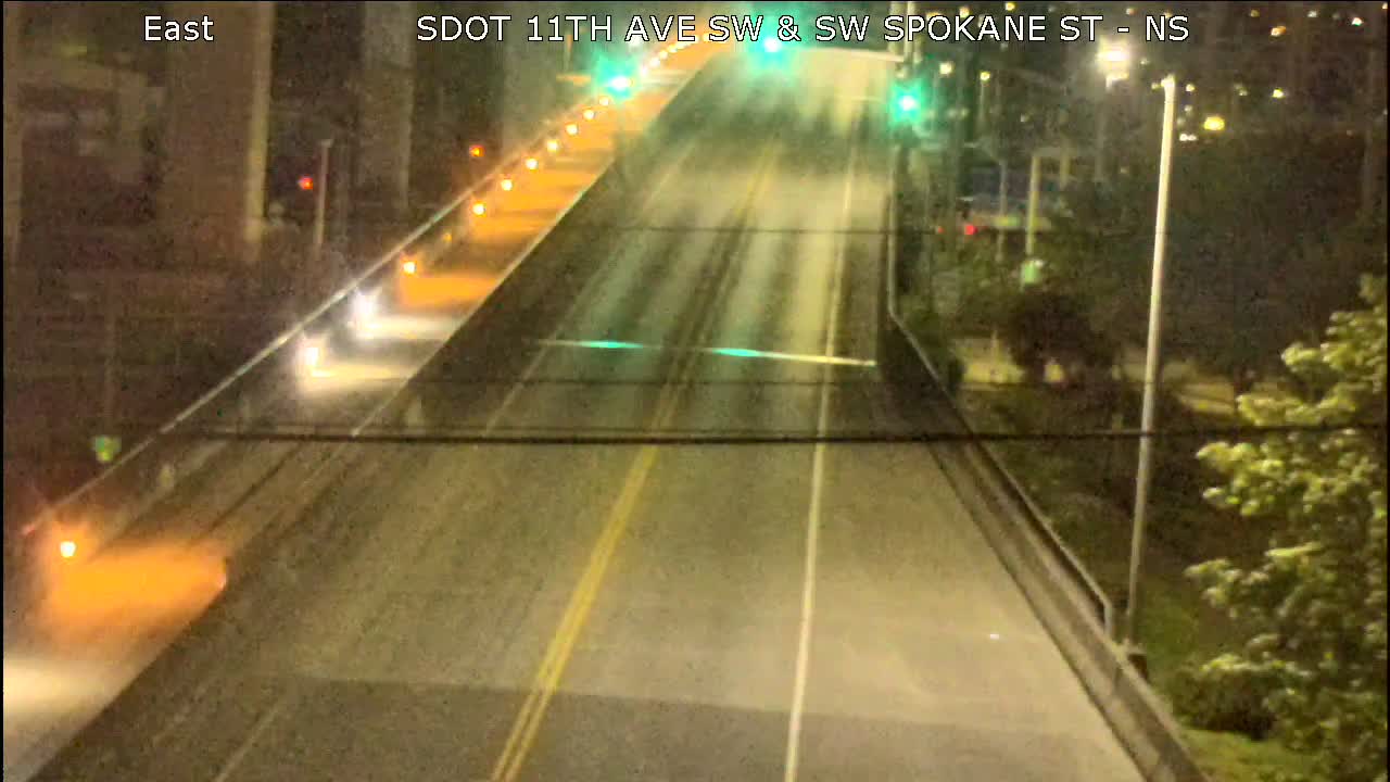
 (WSB photo, looking toward the northwest)
Last month, our brief mention of a reader-reported problem with the 47th/Admiral signal led to a comment discussion about recurring trouble there. One reader said they’d reported it in December and received an explanation that the vehicle-detection system was failing. We followed up with SDOT, which after a lengthy research period provided this response:
We completely replaced the vehicle detection system and made other repairs to this traffic signal in the summer of 2023. The old detection system originally was built with a 5-year product lifespan and had begun to show signs of failure. Since we finished these repairs, our technicians have made several field visits to test the signal, and have not observed any operational problems. The most recent site visit took place last week, when our technician watched the signal for approximately 90 minutes and did not see any issues.
Nonetheless, we will continue to take this issue seriously and will continue to make field visits if people continue to report problems. We appreciate members of the public who have taken the time to notify us when they think they see a problem, and especially appreciate when people are able to provide specific details such as the direction and time of day that they were traveling, which may help us to catch any issues that might not be occurring consistently at all times.
The signal was installed in 2015, two years after the City Council funded it following years of community advocacy for intersection improvements. As for reporting trouble – aside from using the Find It/Fix It app, you can report signal (and other) problems to SDOT via 206-684-ROAD – after-hours, 206-386-1218 – or 684-Road@seattle.gov via email.
The new City Council starts committee meetings tomorrow (Tuesday, February 6). First up: The Transportation Committee, chaired by District 1 Councilmember Rob Saka of West Seattle. When his committee meets at 9:30 am, the agenda includes public comment, an “Introduction to SDOT” (here’s the slide deck), and an “Introduction to Term Permits and Street Vacations” (here’s that slide deck). See the agenda for information on how to participate in the public-comment period, in person at City Hall or via phone; if you just want to watch the meeting, it’ll be live via Seattle Channel. You can look ahead to other council-committee meetings by checking this page, which links agendas once they’re available.
 (SDOT pothole crew, photo via seattle.gov)
If you’ve noticed new and/or worsened potholes since the recent subfreezing cold, SDOT says it’s on them – provided somebody has reported them:
The Seattle Department of Transportation filled 25,000 potholes in 2023, the most potholes filled in the past five years. Crews are continuing to work hard to address more potholes caused by recent freezing temperatures.
SDOT typically fills over 80% of potholes within three days after receiving a request from the public. While this is always the goal, it may take longer than usual to repair all the street damage after a severe winter storm or prolonged freezing temperatures when hundreds of potholes can suddenly appear all at once.
Every winter, storms and freezing temperatures damage Seattle’s streets, as water from rain and snow finds its way through cracks in the ground and erode the pavement. When the temperatures drop below freezing, this water expands into ice which forces the cracks apart and slices up our streets from the inside out. This causes previously filled potholes to reappear. SDOT is prepared for many new potholes to appear this winter due to recent freezing weather and the possibility of more winter storms to come.
SDOT also proactively looks for potholes before they are reported by the public. This year, crews will patrol major streets to search for new potholes. They will prioritize looking along snow plow routes, which are the most essential streets in the City’s transportation system and experience an increase in heavy vehicles during winter storms making them the most likely place for new potholes to appear.
It may take SDOT longer than usual to respond to potholes during severe weather because the crew members who fill potholes are the same people who work day-and-night during storms to drive snow plows, shovel snow, clear landslides, and respond to flooding. When SDOT is faced with multiple challenges, we prioritize our work to promote public safety.
Potholes are less likely to occur on streets that have been recently paved. Thanks to the Levy to Move Seattle, SDOT has re-paved over 215 miles of Seattle streets since 2016. SDOT crews also add a thin layer of protective sealant to over 200 blocks of city streets a year to keep water out and extend the life of the pavement.
SDOT crews cannot fill a pothole that they do not know about. The public can report new potholes to SDOT in a variety of ways, including using the Find It, Fix It App, submitting an online report, emailing 684-ROAD@seattle.gov, or calling SDOT at (206) 684-ROAD (7623).

That’s a page from a slide deck presented earlier this month to the Levy to Move Seattle Oversight Committee in a briefing on levy-funded earthquake-resistance work for bridges around the city. We’ve already reported on two of the projects on the list, Admiral (listed twice because technically it’s two bridges) and Delridge. But the “silt removal” project for the low bridge was something we hadn’t previously heard about. We asked SDOT for more information – at the committee briefing, it was just a quick mention – and got this explanation:
This project will remove silt that has built up around the western bridge foundations and replace rusted steel collars that are secured around the piles that support the bridge pier.
The western pier is supported by several piles surrounded by a steel casing. There is a circular gap between the support piles and the steel casing which allows the bridge to freely move during an earthquake, reducing the force and stress on the pier foundations. There is a steel collar that fits around the top of each of the steel casings to prevent debris from entering the circular space. Over time, the collars have rusted and the gap has filled with silt. A contractor specializing in underwater construction will remove the silt and replace the collars so that the bridge can move as it was designed to do during an earthquake.
We expect to complete this work later this year, and we do not expect that this will have any effect on travelers or vessels. The estimated project cost is about $650,000. This is one of 16 bridge seismic reinforcement projects being funded by the Levy to Move Seattle.
The silt problem apparently goes back quite some time – we found a mention in this 2019 SDOT report.
As previously reported, two of West Seattle’s smaller bridges are set for earthquake-resistance work soon. Bidding has just closed for one, and opened for another:
 (WSB file photo)
DELRIDGE PEDESTRIAN OVERPASS: We reported last month that bidding had opened for this seismic project. As of today, it’s closed. The city had listed the project budget as $5 million; the three “base bids” range from $2.3 million to $3 million. They’ll be vetted before the contract is awarded. Once a contractor is chosen, the construction schedule will be worked out; previously, SDOT has estimated the work could last up to a year.
 (Admiral Way Bridges from Fairmount Avenue, via Google Maps Street View)
ADMIRAL WAY (FAIRMOUNT) BRIDGES: Bidding just opened today for this project (technically two bridges), summarized on the bidding website as follows:
The seismic retrofit of the Admiral Way Bridges includes the following general items of work: strengthening of steel column bents, new bracing at concrete pier bents, retrofit of bridge deck joints, bridge abutment retrofit, slope stabilization, strengthening with Carbon Fiber Reinforced Polymer (CFRP), and steel painting.
The project also is summarized here (though obviously the construction timeline mentioned there didn’t happen; SDOT told us last spring they were aiming to complete it by the end of this year). As for cost, this 2023 presentation cited a 2020 estimate of $15 million. Bids are due February 21st.
Two things to tell you about the West Seattle low bridge (aka Spokane Street Swing Bridge):
(Latest SDOT traffic-camera image of low bridge)
TROUBLE TODAY: Just after noon, as we noted here, the low bridge malfunctioned. Traffic was flowing again before too long, but we asked SDOT about the glitch:
There was a problem with the vehicle gate not moving back into position correctly after a bridge opening for ships. The mechanics manually moved the barrier back into place … The gate was stuck because the rubber lining on the wheels that support the vehicle barrier had degraded and slipped off the rim causing the wheel mechanism to jam. Our mechanics are working to repair the wheel.
WORK AHEAD: Also this afternoon, SDOT announced that the long-planned communications-cable upgrade is about to start:
As part of our ongoing efforts to upgrade and repair the (low bridge), we will be installing a new communications line which connects the bridge control tower to the bridge’s moving parts.
While this work occurs, we will temporarily close a trail spur that branches off the main West Seattle Bridge Trailway. The impact to people who bike, walk, or roll in the area will be minimal. Our project closure site will not affect the main trail over the Spokane St Bridge, or the primary bike route between West Seattle and Downtown used by most people on bikes. Instead, we will be closing a section of the trail that provides an optional loop around the foundation of the Spokane St Bridge used by some bikers.
Map of the WSB Trail, showing the usual route people take (the green dotted line). Our project closure site will close the trail (seen here with a dotted orange line and solid red line) is not part of the usual route people take to reach West Seattle or Downtown.
SDOT says this work will start as soon as Thursday, and the “trail spur” closure won’t reopen before April.

Thanks to Steve for the tip about those covered-up signs near California and Andover. SDOT confirms they’re signs for an expansion of what started as the West Seattle Junction Restricted Parking Zone (RPZ):
These signs are for a single-block expansion of Restricted Parking Zone 35 on SW Andover Street between 44th Ave SW and California Ave SW. We followed our standard practice for single-block expansions as described on our website here.
Here’s what the signs will look like when uncovered:

Here’s the current RPZ map; here’s what this zone covered when launched almost five years ago. This is one of two RPZs in West Seattle; the other is in Fauntleroy,
Announced tonight by SDOT, the Roxbury/Olson crossing-improvement project is restarting and will continue into spring – here’s what they want you to know:
Construction of safety improvements for people walking or rolling at the SW Roxbury St and Olson Pl SW intersection began in May of 2023 and we are set to begin the second and final phase of construction.
WHAT TO EXPECT IN THE COMING MONTHS
Construction work will resume as early as this week
-Work hours are 7 AM to 4 PM, Monday through Friday
-East leg of SW Roxbury St will remain closed for equipment staging and safety area and is local access only
-Work includes installation of new traffic signal poles and wiring, pedestrian signals, and work on sidewalk and road panels
-Painting permanent street markings
-New security guardrail on the northeast corner of the intersection
-Expect noise from equipment backup beeping and engine soundsThis project is expected to be finalized as early as May 2024. The work during this first phase included:
-Shifting the crosswalks across SW Roxbury St so they’re better aligned
-New curb bulbs that extend the sidewalk corners for people walking on the south side of the intersection
-Construction of curb ramps for improved ADA (Americans with Disabilities Act) accessibility
-Temporary crosswalks and stop bars
-Temporary barrier at the northeast corner until a permanent guardrail is installed
-Temporary push button pedestrian crossing at the east leg of SW Roxbury St
 (Photo by Theresa Arbow-O’Connor)
By Tracy Record
West Seattle Blog editor
Washington State Ferries officials spent a lot of time at midday today talking about shortages and what’s being done to alleviate them, during the first of two sessions of their systemwide winter community meeting.
Some of the information came in presentations, and some in an extensive Q&A period that comprised 60 percent of the online meeting.
Almost 200 participants were signed in by the start of the meeting, facilitated by WSF’s Hadley Rodero. When polled to ask which route they used the most, the largest group – 25 percent – cited the San Juan Islands; the Fauntleroy-Vashon-Southworth route accounted for 14 percent of the respondents.
Of the five featured speakers from WSF, chief of staff Nicole McIntosh spoke first, with system updates. She noted the impending departure of ferries head Patty Rubstello (who is staying until a successor is found, McIntosh reiterated). Here are the 2023 stats she presented, including 70 life-saving events and 530 whale sightings:

Ridership is still below pre-pandemic levels:
 (Ferry passing Alki Point last Monday, photographed by Theresa Arbow-O’Connor)
Wednesday afternoon and Thursday evening (January 17-18), Washington State Ferries will host two online sessions of its next systemwide community meeting. WSF says they’ll “focus on systemwide topics like route service, ferry system electrification, and the latest from recruitment and workforce development (as well as) answering questions from participants.” The Wednesday meeting starts at 12:30 pm, the Thursday meeting at 6 pm, and registration links for both are on this WSF webpage. That’s also where you’ll find a link to send question(s) in advance. (If you’re interested in preparatory reading, the newest WSF “contingency plan” has plenty of it.)
 (California/Admiral intersection – Google Maps Street View image)
Stu Hennessey has a dream – a walkable Admiral District.
It’s where he does business as the proprietor of Alki Bike and Board (WSB sponsor), and it’s home to an increasingly busy collection of homes and businesses, including newer apartment buildings such as Luna, Admiral Station, and Element 42, plus Lafayette Elementary, West Seattle High School, and a senior-living complex.
While The (Alaska) Junction has a “walkability score” of 98, the Admiral Junction area scores only 70, says Hennessey, who presented his ideas for fixing that to Tuesday night’s Admiral Neighborhood Association gathering.
In a written version of his presentation, he asks, “Is it our fate to have so much less walkability than the Alaska Junction? Both intersections have about the same amount of daily traffic volume. Both intersections should have the same regard for pedestrian safety. There have been plenty of pedestrian or bicycle accidents along California Ave. SW from SW Stevens to SW College St. Considering the schools, assisted-living facilities, and business storefronts, this neighborhood requires the same amount or more safety improvements to raise our walkability score to the level of the Alaska Junction. The call for better walkability is a call for economic development that will serve businesses and neighbors alike.”
 (California between Admiral and Lander – Google Maps Street View image)
Here are Hennessey’s three proposals – two of which would mirror what’s in place at Alaska Junctiion:
—Walk-All-Ways intersection at California/Admiral. He says, “The biggest safety concern for pedestrians crossing the streets is the right turn on red. The all-walk design would eliminate the right turn on red. Traffic-light synchronization would both keep the traffic flow from backing up and increase the mobility and safety for pedestrians with a 40-second all-walk crossing.”
—Mid-block raised crossings on California between Lander and Admiral and College and Admiral. These would serve people going to and from the Admiral Theater and Admiral Safeway.
—Permanently close SW Lander between California and 44th. Hennessey elaborates, “This is an often-ignored one-way and daytime-temporarily-closed street that could be used as an emergency gathering point for Lafayette School, auto-free pickup of students, and a potential event space such as a farmers’ market.”
So what would it take to make any or all of that happen? He hopes to engage everyone with a stake in the area – residents, businesses, schools, even law enforcement – to petition SDOT. Support could be voiced through a variety of feedback channels, he suggests, and shown via yard signs with a QR code as well as flyers in shop windows, all pointing to the petition.
How to pay for it? Hennessey has thought about that too: “Beyond the next transportation-plan levy, there is available federal funding, and matching grants.” Last year, he said, the feds made $5 billion “available for community-safety improvements. To date, $813 million has been granted to 385 community groups like ours.”
Hennessey is no stranger to community advocacy; he is a co-founder of Sustainable West Seattle and led the campaign to create Puget Ridge Edible Park. His next step toward a more-walkable Admiral District is to build a stakeholders group, and he suggested the ANA should be involved. President Joanie Jacobs said their board will discuss it, but first reaction was positive. Hennessey emphasized that the funding is out there – what will be needed to make any of this happen is widespread organized community effort. He expects to return to the ANA at its next general gathering in March with updates.
 (SDOT photo – new signage for Alki Point ‘Healthy Street’)
One month ago, we reported on the new design for the permanent features of the Alki Point “Healthy Street” – Beach Drive northwest of 63rd, and Alki Avenue west of 63rd. Much ensuing discussion focused on the parking situation. This week, SDOT sent a newsletter recapping the design plans and adding the finalized parking stats for those concerned:
# of ADA parking spaces: 3
# of speed humps: 3
# of parking we’re removing (on Beach Dr SW from 3300 Beach Dr SW to 64th Ave SW): approx. 61 spaces
# of parking spaces available (on Beach Dr SW from 3300 Beach Dr SW to 64th Ave SW): approx. 48 spaces
# of parking we’re removing (Cul-de-sac area: raised crosswalk to 64th Pl SW): approx. 6
SDOT adds, “Existing public parking has also been identified in the area for possible re-striping, improved signage, or other updates to better indicate its availability for visitors.” Construction of the permanent features is expected to happen this spring.
(WSB file photo)
New on the city’s bidding website, several earthquake-safety retrofit projects around the city – including the pedestrian overpass at Delridge and Oregon, between the south end of Youngstown Cultural Arts Center and the east side of Delridge Playfield/Community Center. This comes one year after the decision to keep and retrofit the bridge – after community opposition to proposed removal – was announced. Scope of the project is described as follows:
Seismic retrofit project that involves retrofit of superstructure, columns, and footings through section build up and/or use of CFRP wraps, as well as separating ramps from the structure and building up a lightweight fill support for ramps, adding new expansion joints at the ramps, removing and reinstalling handrails, and modifying the ends of handrails at new expansion joints.
In 2021, SDOT estimated the retrofit cost as ~$4 million; the estimate is now up to more than $5 million. It’s already retrofitted the area’s other pedestrian overpass, the SW Andover bridge over the southwest end of the West Seattle Bridge. The deadline for bids on the Delridge/Oregon project is January 17. The work could last up to a year, according to this slide deck from a briefing last year.
 (November photo by Gill Loring – new turn signal at 26th/Roxbury)
Questions about road work related to the RapidRide H Line, which has continued months after the bus line launched last spring? King County’s project team has held periodic online “office hours” to answer questions, and tomorrow will bring the last one: 5 pm-6 pm Thursday (December 28), via this link (meeting ID: 228 271 1759), also accessible by phone (253-215-8782). The announcement – which was in their final project newsletter – notes that “we are continuing some paving and punch list work.” If you can’t “drop in” during that hour, you can ask a question any time at rapidride@kingcounty.gov.
New Year’s Eve will be fare-free on most transit services again this year. Here’s the info from an announcement sent by King County:
King County Metro: Buses will operate on their regular Sunday schedule and be fare-free from 3 a.m. Sunday, Dec. 31, through 3 a.m. Monday, Jan. 1. Other Metro services operating fare-free include DART, Metro Flex, Community Van, and Access service.
King County Water Taxi: The water taxi will operate fare-free on Dec. 31 but will be out of service on Jan. 1.
Sound Transit: Link light rail and Sound Transit Express buses are fare-free from 5 a.m. Sunday, Dec. 31, to 3 a.m. Monday., Jan. 1. The Sounder Game Train will be available for the Seahawks game and will be fare-free. Sound Transit will operate extended 1 Line rail service on New Year’s Eve, with 15-minute, late-night service. The last southbound trip will leave Northgate Station for Angle Lake Station at 1:57 a.m. The last northbound train will leave Angle Lake Station for Northgate Station at 1:40 a.m. For New Year’s Eve, the T Line will run extended service every 20 minutes until the last train departure.
Seattle Streetcar: Both streetcar lines will operate fare-free on regular Sunday service hours. The South Lake Union Streetcar will operate on New Year’s Eve until 12:30 a.m. to accommodate fireworks viewing downtown.
Seattle Monorail: The monorail will collect regular fares and will operate from Westlake to the Seattle Center until 11 p.m. on New Year’s Eve. After the evening’s events at Seattle Center, service to Westlake will run from 12:30 a.m. to 1 a.m.
For the fare-free-on-New-Year’s-Eve services, fares start up again at 3 am New Year’s Day (Monday, January 1).
 (Photo by Theresa Arbow-O’Connor)
Announced today by Washington State Ferries:
ach year we host two rounds of public meetings to engage and inform those we serve. In January, we are holding two virtual community meetings to offer both midday and evening meeting options. Each meeting will focus on systemwide topics like route service, ferry-system electrification, and the latest from recruitment and workforce development. The remainder of the meetings will be devoted to answering questions from participants.
Attendees will also have the opportunity to provide written public comment during the meeting or beforehand by emailing our Communications team (WSFComms@wsdot.wa.gov).
Register to attend a virtual meeting:
Wednesday, January 17 at 12:30 p.m.
Thursday, January 18 at 6 p.m.
Not mentioned in the announcement but sure to be a topic as well – the impending departure of WSF head Patty Rubstello.
9:07 AM: Washington State Ferries says “unscheduled necessary vessel maintenance” has the Fauntleroy/Vashon/Southworth route down to one boat until further notice, following the #2 schedule. The real-time map shows the boat having trouble is M/V Kitsap, which had problems last week too. Updates to come.
11:59 AM: WSF is moving M/V Suquamish from the Bainbridge-Seattle run so that two-boat service can resume on the Triangle Route.
 (WSB photo, April)
Last spring, SDOT installed a protected two-way bike lane along part of West Marginal Way SW, more than two years after proposing it and eventually agreeing to delay it until the West Seattle Bridge reopened. This week, it’s released data on how the lane addition is – or isn’t – affecting traffic, and what kind of rider usage it’s drawn. Overall, SDOT says, the change has added half a second to the average travel time. It’s also added people biking, walking, and rolling on the stretch, with stats including:

SDOT was hoping to bring down vehicle speeds, with radar feedback signs and a speed limit reduction to 30 mph. Their slide deck says that in fall 2022 vehicles were averaging 37 mph at West Marginal/SW Alaska, and are now averaging just under 38 mph, but at SW Dakota, they’re down to 36.4 mph from 40.2 a year earlier. The slide deck has many other data views, including “interaction” analysis at business driveways, and there’s even more in this 26-page report. Here’s what SDOT says is yet to come on the stretch:

10:54 AM: The Fauntleroy-Vashon-Southworth ferry route is down to 1 boat for now – M/V Cathlamet, on the #2 schedule – because M/V Kitsap is having trouble. It’s been stuck at Southworth but WSF spokesperson Ian Sterling tells WSB the plan is to move it to Vashon, without passengers, for troubleshooting. Until they figure out what’s wrong, they don’t know how long the route will be on 1-boat service. You can check boats’ status via Vessel Watch.
12:54 PM: WSF says the Cathlamet continues alone on the route, with “no set schedule.”
2:42 PM: WSF says it’s moving M/V Suquamish off the Bainbridge-Seattle route to replace Kitsap on the Triangle Route.
 (Image from council-committee agenda, incorporating Google Maps photo)
The city is planning to give two tribes $133,000 for public art on up to 14 columns supporting part of the west end of the West Seattle Bridge. Neither happens to be the Duwamish Tribe, whose longhouse is about a mile south.
The project is with the Suquamish and Muckleshoot Tribes, described in the plan as having “Duwamish ancestors” (the same description used during the ceremony before the bridge reopened last year).

The art project is on the agenda for tomorrow morning’s meeting of the Seattle City Council Transportation and Public Utilities Committee; documents say it’s been under discussion for a year and a half.
If you just gave the agenda a once-over, as we did, you might not have noticed – the item is #10 on a busy agenda, with no mention of art or the bridge in the item title – “AN ORDINANCE relating to the Seattle Department of Transportation; authorizing and directing the Director of the Seattle Department of Transportation to execute interlocal agreements with the Suquamish (suq̀ʷabs) Tribe and Muckleshoot (bəqəlšuł) Tribe; and ratifying and confirming certain prior acts,” until you open the slide deck linked from the agenda.

A community advocate called our attention to it. As explained in another agenda document:
This legislation would authorize the SDOT Director to execute interlocal agreements with the Suquamish and Muckleshoot Tribes, funded by $133,000 in remaining funds from the Reconnect West Seattle program. Reconnect West Seattle is the nearly complete mitigation program within the larger West Seattle Bridge Safety Project (ie., the WSB repair and mitigation program). These funds have been budgeted since early in the project for such a tribal partnership … The agreements compensate the two tribes for painting art murals on the Fauntleroy Expressway columns, near the intersection of W Marginal Way SW and Chelan Ave SW which connects the West Seattle Junction with the West Seattle High Bridge. The purpose of the project is to honor the people whose homeland, hunting, and fishing territories Seattle now inhabits, and to build trust between the City and the federally recognized Muckleshoot and Suquamish tribes. Under the agreement, the murals must be completed in 2024 and each tribe will be compensated up to $66,000 for their work
Federal recognition is something the Duwamish Tribe has been fighting for for decades, winning it briefly at the end of the Clinton Administration, only to have the incoming Bush Administration cancel it.
Though the documents say the art will be entirely the Muckleshoot and Suquamish tribes’ responsibility, they also say the city will have to review and approve each design and its accompanying narrative, with these parameters:
The City’s design review will focus on ensuring that the Column Murals’ colors do not mimic those used in traffic signage and that the content does not contain offensive material directed toward any group of people. The City shall retain the right to review and provide feedback on the proposed design within thirty (30) days from the date of receipt of the submission.
And for everyone who worries about defacement risk for public art:
The Tribe shall adhere to the recommendations provided by the City concerning the Column Murals installation to ensure optimal and long-lasting results, as well as ease of cleaning in the event of graffiti. Recommendations may include, but are not limited to, the following: installation within the dry season of 2024 (e.g. June – August); preparation of columns (e.g. power washing, priming), application of quality exterior latex paint; mural protection (e.g. MuralShield), graffiti protection (e.g. Sherwin-Williams Anti-Graffiti Coating). The City shall be responsible for obtaining and covering the cost of any necessary permits for the Column Murals. The Tribe shall be responsible for securing traffic control support from a licensed traffic control provider … The Tribe and the City shall share the responsibility of maintaining and repairing the columns and Column Murals as set forth herein.
This won’t be the first official art project on bridge columns; toward the other end of the bridge, beneath the Spokane Street Viaduct section, bar-code-inspired designs were painted on columns in a $400,000+ project more than a decade ago.. Meantime, you can comment at tomorrow’s 9:30 am committee meeting, remotely or in-person, as explained on the agenda, or just watch via the Seattle Channel.
 (SDOT photo)
More than a year has passed since SDOT announced that the Alki Point Healthy Street – Alki Avenue west of 63rd and Beach Drive north/west of 63rd – would be permanent. A few months later, the city said it was working on the permanent design. They’ve just unveiled finalized designs centering on four locations along the stretch, including the addition of various features including a “cul-de-sac,” a “walking and rolling” lane adjacent to part of the sidewalk, and removal of 60+ on-street parking spaces, while marking three new ADA spaces:
Location 1: Alki Ave SW & 64th Pl SW
-Paint & post cul-de-sac to give drivers an opportunity to turn around before the “street closed” sign
-“Street closed” sign on durable concrete cylinders to reduce cut-through driving on the Healthy Street
-Wayfinding pavement markings for a smooth transition from existing bike path to the Healthy Street
-Approximately 6 parking spaces removed in Cul-de-sac area – raised crosswalk to 64th Pl SWLocation 2: Alki Ave SW and Point Pl SW
-Speed humps to reduce traffic speeds
-Sharrow pavement markings to enhance wayfinding for people biking, rolling, and walking
-Stop signs at intersecting streetsLocation 3: Alki Ave SW and Beach Dr SW
-Paint and post to delineate 10’ of additional space for walking/rolling along the existing sidewalk adjacent to the beach
-Sharrow pavement markings to enhance wayfinding for people biking, rolling, and walking
-Stop signs at intersecting streets
-ADA accessible parking along Beach Dr SWLocation 4: Beach Dr SW and 64th Ave SW
-Paint and post to delineate 10’ of additional space for walking/rolling along the existing sidewalk adjacent to the beach
-Sharrow pavement markings to enhance wayfinding for people biking, rolling, and walking
-Stop signs at intersecting streets
-Approximately 61 parking spaces removed on Beach Dr SW, from 3300 Beach Dr SW to 64th Ave SW
-Approximately 46 parking spaces to remain available on Beach Dr SW, from 3300 Beach Dr SW to 64th Ave SW
The first “design update” is similar to what was proposed in “early design” – you can compare via links toward the bottom of the project page – but the other three have significant additions, including the “walking/rolling” lane and more speed humps. This is planned for installation next year. Meantime, SDOT’s update says there’s one stretch they haven’t finalized yet – Beach Drive between 63rd and 64th. This and other “Healthy Streets” around the city originally were set up during the early months of the pandemic, but many have been made permanent as reduced-vehicle-traffic streets.
A WSB reader texted:
Wondering if you might do a story on the new traffic violation cams on the high bridge – focusing on bus lane violators. I commute daily and take the 1st Ave exit right after the 99 exit and I wait until the last set of red painted lines that say BUS ONLY but I got a cautionary warning letter for this as a traffic violation . In the future the fine will be $75. Can you investigate where/ when it is legal to move over To the far right lane to exit on first?
It’s been three months since the last announcement about the new camera enforcement – when SDOT said in early September that installation was imminent. So first we asked SDOT if the camera – part of a “pilot” program also involving other locations in the city – was indeed up and running and citing. Yes: “The transit lane traffic safety camera on the West Seattle Bridge (high bridge), just east of State Route 99, has been activated. The first time someone is caught in a violation, they will be mailed a warning letter. For any new violations after that, they will be mailed a $75 ticket.”
How many warnings/tickets? SDOT refused to say:
This camera is part of an ongoing pilot program intended to evaluate the effectiveness of automated traffic safety camera enforcement in transit only lanes. The draft report on the effectiveness of the program will be submitted to the State Legislature in July 2024 and will also be available publicly at that time.
To get a report sooner, the spokesperson replied, we’d have to file a public-disclosure request.
To the original texter’s question, about the exact location to avoid if you don’t want to be cited: “The entire bus lane, which begins approximately 0.5 miles west of the exit to NB SR99, is restricted to buses only. The camera is located east of the exit to NB SR99. Drivers taking the exit to NB SR99 will not be impacted by the camera.” Here’s the design-document excerpt that SDOT sent us for a similar question pre-installation, showing the enforcement zone in yellow-green:

Meantime, no hint yet of when newly authorized camera types – like “racing” – might be installed, but we’re continuing to follow up.


| 26 COMMENTS