West Seattle, Washington
11 Saturday
![]() If you live and/or work in Highland Park, Riverview, or South Delridge, your community council HPAC invites you to the monthly meeting online tonight at 7 pm, featuring guests from SDOT. The main topic: The newly unveiled details of the Highland Park Way/Holden Safety Project. A brief West Seattle Bridge update is planned too. See the agenda, and how to access the meeting via Zoom or phone, by going here.
If you live and/or work in Highland Park, Riverview, or South Delridge, your community council HPAC invites you to the monthly meeting online tonight at 7 pm, featuring guests from SDOT. The main topic: The newly unveiled details of the Highland Park Way/Holden Safety Project. A brief West Seattle Bridge update is planned too. See the agenda, and how to access the meeting via Zoom or phone, by going here.
 (WSB photo)
By Tracy Record
West Seattle Blog editor
As we first reported last weekend, the mayor has set up a community advisory group for the West Seattle Bridge project, and it’s being formally announced today. So are details of the technical advisory group that was already in the works. We also have a general update on what’s up with the bridge, two months after it was closed.
First, the West Seattle Bridge Community Task Force. It’ll be co-chaired by Greg Nickels, the West Seattle-residing former mayor who’s remained active in transportation advocacy, and Paulina Lopez, a longtime South Park community leader/advocate. From the announcement:
… we are launching the Task Force to ensure that the many voices and concerns of the community are not only heard, but consistently advocated for.
The group is comprised of elected officials and representatives from West Seattle businesses, neighborhood groups from the Junction to Georgetown to South Park to Highland Park to SODO, and industrial and maritime businesses and their workers.
Members will help ensure transparency, clear communication, and broad community engagement and understanding around both traffic mitigation efforts and the future path forward for the West Seattle
High-Rise Bridge as we address new data, public input, fiscal challenges, and many other important factors that will inform consideration of repair versus replace scenarios.
Here’s who else is on the Community Task Force:
 (Bald Eagle, photographed by Mark Wangerin)
Good morning. Notes for the holiday:
TRANSIT
Metro: Sunday schedule
Water Taxi: Not running
Sound Transit: Sunday schedule
TRAFFIC CAMERAS
Our page highlighting local cameras is here
SDOT’s map with cameras and alerts from around the city is here
 (Bald Eagles, photographed by Dan Ciske)
POPPIES
Stop by American Legion Post 160 (3618 SW Alaska) if you are out – details in our preview, including BBQ food – with a discount for veterans – next door!
TAPS ACROSS AMERICA
3 pm – play if you can!
= (Photo courtesy Kevin Freitas, originally published on Twitter)
Two months ago tonight, on March 23rd, the West Seattle Bridge was closed because of collapse concerns, with only a few hours’ warning to the public. Will it ever reopen? The city has yet to announce whether it considers the bridge fixable. Here’s a quick look at some of what’s been happening in the meantime:
MAYOR ASSEMBLING COMMUNITY TASK FORCE: Earlier this month, as reported here, the District 1 Community Network suggested a stakeholders’ group of some sort was needed, to be sure the community has a voice in key decisions. Multiple sources have confirmed to WSB that Mayor Durkan is doing exactly that. Who’s on it, and what it’ll be charged with, we don’t know yet; we asked the mayor’s office for comment when we got first word of this, but no answers yet.
OTHER GROUPS: The West Seattle Chamber of Commerce also has a committee focused on the bridge closure, and the new community coalition West Seattle Bridge Now continues ramping up.
BUT WHAT’S HAPPENING *ON* THE BRIDGE? Monitoring instrumentation has been installed, and a three-scenario emergency-response plan spells out what happens if those instruments – or the daily inspections – show it’s on the verge of collapse. To try to avoid that, stabilization work is planned; SDOT announced the contractor for that three weeks ago.
GETTING AROUND WITHOUT THE BRIDGE: SDOT is working on neighborhood-specific traffic plans, which director Sam Zimbabwe says will be ready – at least in draft version – in early June.
WHERE TO GET UPDATES: SDOT has a catch-all page for its bridge updates and background info, here; all our 50+ bridge-related reports dating back to the closure announcement is archived here.

Back in March, we reported on the final design of the next big (planned) road project in West Seattle, Delridge Way repaving (north of Orchard) and other changes to accompany the conversion of Metro Route 120 to the RapidRide H Line. Today, SDOT announced construction will start as soon as June 8th, and launched an “online open house” with key points of the project, including a video presentation. Take some time to go through it – a lot of information is interactive/nested, requiring a click or a pull to see – and then note the feedback opportunity at the end. Also, we have a followup meeting with SDOT tomorrow for an in-depth preview as we traditionally do for major transportation projects, so we’ll be watching to see what comes up in comments. The H Line is scheduled to start service in fall 2021,
 (WSB photos/video)
Like the West Seattle Food Bank, the White Center Food Bank – which serves part of WS too – is among the food banks getting help from the Washington National Guard. And today, the helpers got some help themselves – eight bicycles!

That’s Stephen Rowley from Cascade Bicycle Club. Today, he delivered loaner bikes to the WCFB for the National Guard members to use. Their leader, Sgt. Aaron Smith, explained:
Rowley told us that these bicycles are usually used in activities at schools, but since those aren’t happening right now, they were available.

The borrowers are expected to keep them for several weeks.

9:45 AM MONDAY: For decades, the Highland Park community has been fighting for safety upgrades at Highland Park Way and Holden. Within a week of the West Seattle Bridge closure, a “temporary” signal was rushed into place, followed by a few other tweaks. But SDOT promised the full “safety project” would still happen, and has just officially unveiled an early-stage plan, outlined in a flyer that arrived in some HP mailboxes over the weekend (thanks for the tips!). It spans other streets too, despite the title, but HP Way/Holden is the heart of it. Here’s what the proposal looks like:

(You can see it larger here in PDF.) The plan includes a protected bike lane on the uphill side of Highland Park Way, from West Marginal Way SW at the bottom of the hill to Holden at the top. That is discussed further, along with other nearby plans, in the slide deck presented by project developer James Le in this video from the project website:
Here are two key slides showing potential side-street “traffic calming” (Monday afternoon update – the entire deck is now online):


Once you’ve considered all that, you can take the “early design survey” in which you’re asked to prioritize what you think the area needs. It’s open through May 31st. A few days before that, SDOT expects to be part of the next monthly HPAC meeting – 7 pm Wednesday, May 27th; watch for details at hpacws.org.
11:16 AM TUESDAY: We asked SDOT to clarify the channelization proposal for the Highland Park Way hill, and the reply, just in, confirms the interpretation that one lane is proposed for downhill motor-vehicle traffic:
Highland Park Way SW between SW Holden St and West Marginal Way currently has two southbound lanes and two northbound lanes. Creating a southbound uphill protected bike lane would provide a needed bike connection between the Duwamish Trail and the Highland Park neighborhood. Creating space for this bike lane would require removing one downhill, northbound car lane. This change would also have a safety benefit by reducing speeding toward West Marginal Way.
Traffic modeling and counts of the number of turning vehicles conducted prior to the West Seattle bridge closure indicated that removing the northbound car lane would have a minimal impact to traffic. However, we know that Highland Park Way SW is one of the most heavily used detour routes into and out of West Seattle. We have been listening closely to community comments and monitoring traffic since the bridge was closed and expect to make a decision on this proposed change in the coming weeks based on the community’s input and new traffic data.
This week’s West Seattle Bridge closure update in Councilmember Lisa Herbold‘s weekly newsletter includes 4 new updates related to traffic – first, the latest volumes at key points around the area:
Traffic levels continue to be high in the most recent counts on West Marginal, and are up slightly on the South Park Bridge, Roxbury and 15th, 35th and Raymond, and on East Marginal Way and 1st Avenue South. Citywide traffic levels are around 50% of normal volume.
Second, Herbold’s newsletter also says travel times for West Marginal Way SW are now available via the message boards at Admiral Way/34th SW, Fauntleroy Way/38th SW, and 35th SW/SW Snoqualmie.
Third, something related to the traffic-management planning mentioned in last night’s “Town Hall”:
SDOT is working on neighborhood-based traffic management plans to prepare for the significantly higher levels we can expect. Draft plans for the neighborhoods that will see increased traffic off the peninsula (e.g. South Park, Highland Park/South Delridge/Riverview/Roxhill, as well as SODO and Georgetown) will be released for public comment and further work with the community in early June; SDOT has met with a number of community groups and committed to further meetings to discussing the draft plans. SDOT is considering public suggestions. You can send ideas to SDOT directly at 684-ROAD@seattle.gov. I’m happy to pass on suggestions as well.
And fourth, regarding the oft-suggested idea of moving some ferry traffic from the Fauntleroy dock:
Washington State Ferries replied to my letter requesting they consider re-directing some of the ferry traffic from Vashon and/or Southworth, that usually travels to the Fauntleroy ferry dock, to Downtown Seattle instead; and that they consider trips from Fauntleroy to Downtown. Numerous constituents have written to suggest this.
Ferries replied they are “working with transportation agencies and stakeholders from across the city of Seattle and King County to better understand this dynamic situation, and together we are analyzing a variety of options to address this challenge.”
I appreciate Ferries’ reply, and commitment to work with the City, and analyze options.
Ferries also noted challenges related to their terminals include the limited capacity at Fauntleroy; the reconstruction of Colman Dock through 2023, reducing the number of operating slips from 3 to 2; potential impact to Seattle/Bremerton and Seattle/Bainbridge routes and those communities; the number of ferries they have available; and public input requirements for any schedule changes.
Ferries also notes that their most recent origin-destination study showed 60% of passengers aren’t heading downtown or points north (which is why my request was to “directing some of the traffic between Vashon and/or Southworth to Downtown Seattle”).
If you don’t already get Herbold’s weekly updates, you can find them – usually published Fridays – at herbold.seattle.gov.
Though the announced-at-the-last-minute “West Seattle Town Hall” a few hours ago was not primarily about the bridge, that was a major topic, unsurprisingly. No new information, but SDOT director Sam Zimbabwe‘s part of the program offered some new framing of where things stand. We recorded video of the entire event, which we’ll publish in a separate report; here’s a clip with just his 10-minute segment:
We screengrabbed key slides to summarize his update. First, project priorities:

Then he went through a quick recap of the heart of the emergency plan whose key points were unveiled last week (WSB coverage here):

This next slide was the first time we’ve seen SDOT try to give a visual explanation of the dramatic loss in street capacity to and from West Seattle:

Then, what seemed tailored to those who are worried nothing’s being done:

This one, for those wondering why the bridge isn’t already being repaired or demolished:

And here’s another promise that they’re working on traffic management, with the stay-home order potentially lifting in less than three weeks:

Another slide along the way recapped how many meetings they’ve spoken at:

Earlier in the event, both Mayor Jenny Durkan and Councilmember Lisa Herbold included the bridge in their opening remarks. Durkan described the bridge as “a vital, vital piece of infrastructure … for our entire region.” She says she’s been discussing the situation with all levels of government – federal, state, county, regional. She also reaffirmed her support for current restrictions on the low bridge, saying it has its limit. But she promised the city will “do everything” it can “to increase mobility” (for West Seattle).
As she has before, Herbold declared the bridge closure a “crisis.” In counterpoint to the mayor, she said she will continue advocating for some changes in low-bridge restrictions, such as opening it to personal-car drivers during late-night/early-morning hours. (In subsequent Q&A, the mayor seemed to soften a bit on that, saying “all requests” would be considered.) Herbold also summarized recent developments such as the SFD announcement that another medic unit and ladder truck would be added to this side of the Duwamish River.
Again, we’ll recap the rest of the two-hour event – which featured more than half a dozen other city department heads – in a separate story.
As reported here last Friday, Councilmember Lisa Herbold announced SDOT planned to repave two blocks of SW Roxbury, the badly rutted section between 16th SW and 18th SW. We subsequently asked SDOT about the timeline, and today the department confirmed the work will be done before the end of the month, and once it starts, will last up to a week. They also sent this flyer that will be mailed to nearby homes and businesses this week:
(You can also see it here in PDF.)
From Washington State Ferries:
Due to necessary repairs, the 90-car Sealth will replace 124-car Cathlamet as the F/V/SW #2 vessel beginning with the (updated) 4:35 p.m. Fauntleroy to Vashon sailing. This will cancel the 3:55 p.m. Southworth departure

One week after SDOT went public with some details of its emergency plan in case of West Seattle Bridge failure or imminent failure (WSB coverage here), it’s just published a close-up look at the new monitoring system. The graphic above is from the new SDOT Blog update, which also includes photos of some of the monitoring equipment. Also explained – the monitoring is also key to the biggest decision yet to be made. Three main purposes are listed:
*Keep us informed on how the bridge reacts to environmental changes, bridge stabilization measures, temporary shoring, and potential future repairs.
*Give us a better indication of bridge distress that could warn of impending failure.
*Guide us to a decision about the technical feasibility of repair or replacement.
SDOT says the system includes cameras, movement sensors, and crack monitors, noting:
The new intelligent monitoring system is already ‘talking’ to us and telling us that there is some potential for failure. What we don’t yet know is how great that potential is. The new system will help us better determine that.
SDOT adds that “after we collect a few weeks’ worth of data”:
Analytic modeling will interpret the data to gain a baseline understanding of the bridge’s behavior. If we observe stable behavior, the bridge will continue to be monitored during and after the temporary crack arrest measure installation and the Pier 18 restrained lateral bearings’ release, to see how the bridge reacts.
See the entire update here.

With a lot of discussion sparked by the city’s most-recent “Stay Healthy Streets” announcements, you might be interested in this (online) meeting Wednesday: The program is scheduled to be discussed when the Seattle Pedestrian Advisory Board meets tomorrow (Wednesday, May 13th). This isn’t a vote or review, but rather, it’s on the agenda of the SPAB as “Stay Healthy Streets and Social Distancing Q&A,” with guests from SDOT. The meeting also includes two public-comment periods. You can “attend” the meeting either online or by calling in (206-686-8357, conference ID 150 994 262). The meeting is set to start at 6 pm Wednesday, with public comment at 6:15 and 7:40, bracketing the SHS/Social Distancing discussion.

As of today, that’s the new map for the South Alki “Stay Healthy Street,” according to SDOT traffic engineer Dongho Chang, who announced via Twitter this morning that it “has been revised based on feedback from SPD and community. We’ll update with additional signing and ADA parking … next week.” The expansion – adding the west end of Alki Avenue, west of 63rd – was foreshadowed by the exchange we featured in Friday night’s virus-crisis roundup. “Stay Healthy Streets” are closed to through traffic to expand space for “distanced” pedestrian and bicycle use, as explained in the original announcement. The city said last week that 20 miles of them will be permanent, including West Seattle stretches in High Point and Puget Ridge/Highland Park. A new round of announcements followed, with Beach Drive’s northern end included, and now the west end of Alki Avenue’s been added to that.
Two road-work notes tonight:
TWO BLOCKS OF ROXBURY PAVING: From this week’s West Seattle Bridge-related update in City Councilmember Lisa Herbold‘s weekly newsletter:
SDOT is planning to repave the westbound lanes of Roxbury between 16th and 18th Ave SW as early as mid-May, depending on weather. SDOT indicates they are coordinating with King County, which has jurisdiction over the eastbound lanes. SDOT will be doing outreach in advance.
We’ll be following up on Monday.
35TH/AVALON WRAPUP: From SDOT this afternoon:
• We will begin work to make safety improvements to the northbound bus stop at SW Genesee St as soon as May 11. Please expect:
o No parking signs and traffic control in the work area
o Loud noise and increased truck traffic
o Bike lane shifts as we work at the bus stop
o A temporary closure of the nearby sidewalk with a posted detour route
o A temporary closure of this bus stop• Next, we will continue installing pavement markings on 35th Ave SW and SW Avalon Way as well as install flex posts for the protected bike lane and complete miscellaneous minor activities
o Please follow any posted no-parking signs on SW Avalon WayWe will take down our no-parking signs where and when they are no longer needed.
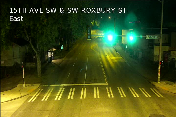
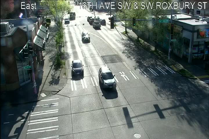
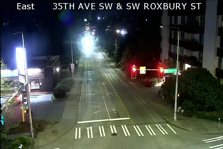
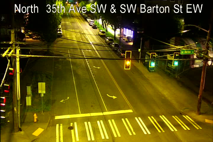
Just got word from SDOT today – they’ve added six new publicly viewable traffic cameras, on SW Roxbury and on 35th SW. We’ll be adding them to our traffic-cams page and weekday-morning traffic watch. From east to west and south to north, they are:
15th/Roxbury:
16th/Roxbury:
35th/Roxbury:
35th/Barton:
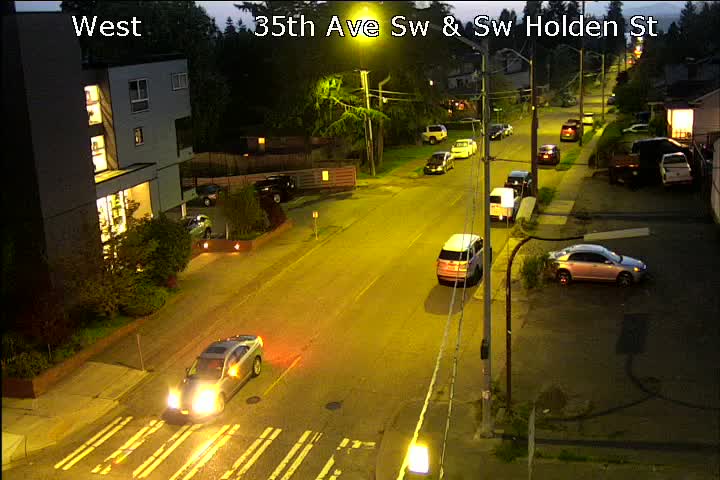
35th/Holden:
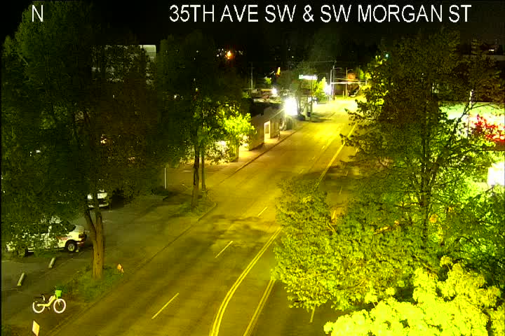
35th/Morgan:
Any more on the way? We’ve asked, and we’ll add the reply when we get it.
P.S. You also can find these cameras, and others around the city, via SDOT’s traffic-info map.
 (WSB photo, 21st SW at 22nd SW on Puget Ridge, earlier this week)
4:21 PM: In a media briefing we covered earlier this afternoon, Mayor Jenny Durkan announced the first 20 miles of closed-to-through-traffic “Stay Healthy Streets” – announced as an experiment to give more people room to “socially distance” while walking, bicycling, etc. – will be permanent. That includes the first two stretches in West Seattle – one in High Point, another in Puget Ridge/Highland Park. She said it’s part of “rebuild(ing) a better Seattle,” in hopes vehicle-traffic and pollution reductions will continue post-pandemic. (We asked about the HPAC request to drop SW Trenton from the Highland Park stretch; SDOT director Sam Zimbabwe said they’re still evaluating that.) Also announced, an SHS expansion this weekend that will include the northernmost stretch of Beach Drive, between Alki Avenue and 63rd SW, alongside Constellation Park. The mayor also announced the city would seek to accelerate projects around the city making it safer to walk and ride – no specific list yet.
4:44 PM: Here’s the official SDOT announcement, which also notes they’ll have a survey out soon.
 (WSB photo from April, new signal at Highland Park Way/Holden)
HPAC – the community council for Highland Park, Riverview, and South Delridge – got a fast reply from SDOT on its letter centered on 13 requests related to the West Seattle Bridge closure and its effects on those neighborhoods. We spotlighted the letter here on Tuesday; HPAC circulated the response tonight. It’s signed by Heather Marx, who’s leading the West Seattle High-Rise Bridge Safety Project. The letter, which you can see in its entirety on HPAC’s website, also incorporates topics from HPAC’s April meeting (WSB coverage here). From the response, here are HPAC’s points, and SDOT’s replies:
… Below are the specific requests we heard from HPAC – at both your meeting and in your letter – with the status of each request:
Highland Park Way SW and SW Holden St Intersection
*Request for a left-hand turn signal for turning onto SW Holden St from northbound lane on Highland Park Way SW
Status/update: We installed a temporary traffic signal at this intersection and it’s not currently possible to add a left-hand turn signal to it. We are, however, sharing this feedback with the team designing the permanent traffic signal scheduled to be installed in 2021.*Request for extra traction on uphill southbound lane on Highland Park Way SW
Status/update: The Highland Park Way SW and SW Holden St Safety project team will evaluate high friction surface treatment. This treatment has typically been done where crashes have occurred when roadway conditions were slippery.*Request for separate green signals for pedestrians and drivers in the northwest corner of the intersection
Status/update: We installed a temporary traffic signal at this intersection and it’s not currently possible to add these features to it. We are, however, sharing this feedback with the team designing the permanent traffic signal scheduled to be installed in 2021.Turning from arterial streets onto SW Holden St
*Request to see painting and/or signage to prohibit blocking of the intersections
Status/update: Because these treatments have limited effectiveness and high maintenance costs, SDOT is focusing on more effective tools, many of which are below and will also be reflected in the neighborhood traffic plans we are preparing.Traffic calming in the neighborhood
By Tracy Record
West Seattle Blog editor
Since a brief West Seattle Bridge update was on the agenda, we listened in on last night’s monthly meeting of the Levy to Move Seattle Oversight Committee.
That wasn’t the only item of interest, though – the meeting also touched on two curiosity-piquing potential future tools in the ongoing Vision Zero safety program, and an unsurprisingly dour budget update.
First, the bridge. While its emergency needs obviously aren’t part of the original plan for the levy that voters passed in 2015, which is what this all-volunteer advisory group monitors, SDOT put it on the group’s radar last month. So deputy director Lorelei Williams presented a short update last night.
10:58 AM: Thanks for the tip. Washington State Ferries has just confirmed there’s a problem at the Fauntleroy dock – the transfer span is currently “out of service,” with an electrician on the way. That means a scheduled departure is on hold, and the Cathlamet, which was on its way to land, is waiting offshore. Updates as we get them.

11:09 AM: Vessel Watch shows both ferries now headed to Vashon, and the WSF cam (screengrab above) shows vehicles waiting on the Fauntleroy dock are being turned around.
12:01 PM: The Fauntleroy dock is still out of service.
1:36 PM: WSF just announced that repairs are complete and service is resuming with the 1:40 pm Vashon departure to Fauntleroy.
Even the few park-and-rides in West Seattle aren’t busy now – but that’ll eventually change. If you’re a park-and-ride user, here’s a survey you’re invited to take. It’s about whether it would be helpful to know how many spaces are available at your park-and-ride before you leave home.

With no detailed city plan yet for handling West Seattle Bridge-less mobility when the stay-home order lifts, local groups are continuing to spell out their proposals. Today, we hear from HPAC, the community council for the areas most affected by detoured traffic – Highland Park, Riverview, South Delridge. While SDOT guested at HPAC’s meeting April 22nd (WSB coverage here), they had no specifics beyond the Highland Park Way/Holden signal that was installed in the first week post-bridge closure. So HPAC has sent a letter (see it here in PDF) to the mayor, council, and SDOT, noting that “… we are now in week 7 of the closure and very few of the public concerns that have been raised have been adequately addressed.” HPAC has these 13 specific concerns/proposals:
… Issues and areas that need to be addressed before the stay-at-home order is lifted:
1. At the intersection of Highland Park Way SW and SW Holden St:
● A left-hand turn signal is needed for turning onto SW Holden from Highland Park Way/9th Ave SW northbound. Currently, traffic coming up the hill on Highland Park Way and going right does not stop, with SW Holden being so narrow, only one car being turning onto SW Holden, so traffic trying to turn left are stuck at the light for several cycles or cutting through SW Portland St at higher speeds.
● Extra traction on the uphill southbound lane on Highland Park Way.
● Separate green signals for pedestrians and drivers in the northwest corner of the intersection.2. Traffic signal adjustments to address traffic backups at the following intersections:
● Add a left hand turn signal at 16th Ave SW and SW Holden St as previously requested for
over the last 6 years.
● Delridge Way SW and SW Holden St.
● Orchard St. and Delridge Way SW
● 8th St and SW Roxbury St.3. Traffic calming features on our neighborhood streets:
● For the school zones of Chief Sealth HS, Roxhill Elementary, Sanislo Elementary and Highland Park Elementary.
● Police presence to curb excessive speeding on 16th Ave SW
● Signage at 4-way intersections to ease transit for vehicles, bikes and pedestrians. Signs
along SW Thistle St at 20th and 18th Ave. Stop sign at 11th and Kenyon St.
● Work with the neighborhoods to identify streets to become one-way to help mitigate cut- through traffic.4. Turning onto SW Holden St from streets both east and west of Delridge Way is extremely difficult with increased traffic.
● Mitigation requested.
5. West Marginal Way S:
● Increase the number of lanes to get onto the on ramp for the 1st Ave bridge.
● Request for better bike lane marking at the intersection with Highland Park Way SW
● Request to fill potholes and fix road deterioration near the railroad tracks
● Request for two lanes northbound at the intersection with Highland Park Way SW6. Pedestrian path on the east side of Highland Park Way after the SW Holden intersection:
● Request to consider widening the path to allow for more use
● Request to clean moss off from path7. Left-hand turn signal requests at the following intersections:
● 16th Ave SW and SW Holden St
● 16th Ave SW and SW Roxbury St.
● 8th Ave SW and Roxbury St.8. King County Metro Route 131
● Make a bus-only lane starting at SW Holden and Highland Park Way going on through to West Marginal Way then over the 1st Ave bridge toward Seattle.
● Request to adjust signal at Highland Park Way SW and SW Holden for bus priority
● Increase Route 131 service.9. We want to clearly understand the traffic patterns throughout the peninsula. SDoT has never taken into consideration the east-west traffic flow throughout West Seattle. We want to know what routes people are taking and which streets are becoming major arterials. Monitoring should be placed at the following intersections:
● SW Orchard St. and SW 35th Ave
● SW Orchard St. and Delridge Way SW
● SW Holden St. and SW 35th Ave
● SW Holden St. and Delridge Way SW
● SW Thistle St. and California Ave SW
● SW Thistle St. and SW 35th Ave
● SW Thistle St. and Delridge Way SW
● SW Trenton St. and SW 35th Ave
● SW Trenton St. and Delridge Way SW
● SW Barton St. and SW 35th Ave
● SW Henderson St. and Delridge Way SW
● SW Henderson St. and 9th Ave SW
● SW Roxbury St. and 35th Ave SW
● SW Roxbury St. and Delridge Way SW
● SW Roxbury St. and 9th Ave SW
● Olson Pl SW and 1st Ave S10. For the City of Seattle to increase Metro bus service for access for east and west transit on the peninsula itself i.e. access to California St./ Junction areas only offer the 128, which is hard for the rest of the peninsula to get to without using their cars.
● The transfers through the Westwood Village has been difficult for Highland Park riders since the reroute of the 136/137. Highland Park and Delridge Neighborhoods have been designated food deserts by the city.
11. A commitment from the City to repair the streets that were damaged during the bridge closure.
● Once traffic resumes we will have a better understanding of which of the streets that will be, but assume at least: Roxbury St, Delridge Way SW, SW 35th Ave, Highland Park Way SW, and Olson Way SW.
12. Heavy freight routes clearly designated and enforced.
● This type of vehicle will cause massive and immediate damage to our more residential
streets (i.e. Holden St) and will significantly slow traffic since these types of vehicles will
have issues turning the tight corners. Both Avalon St. and Roxbury with their wider lanes
and concrete enforced lanes are better suited for this type of transit.13. We want an immediate bridge replacement plan without a $33 million expenditure for the current bridge or a two-year evaluation period. SDOT’s current plan will put an undue burden on the daily lives of our West Seattle residents.
Please learn from the I35 bridge failure and replacement in Minneapolis and the rapid rebuild of the Genoa, Italy bridge. No one waited for two years before making a decision on viability – just replace this bridge.
The $33 millioh reference, if you missed the original report, goes back to the April 15th briefing covered here – it’s the projected cost of stabilizing the bridge, planning traffic control, and doing maintenance on the low bridge.
 (WSB photo, looking east on Trenton from 17th)
MONDAY REPORT: As announced last week, more east West Seattle streets are now closed to through traffic as part of the city’s “Stay Healthy Streets” program. The first round two weeks ago included streets in High Point and a bit south; the new stretch is primarily in Puget Ridge and Highland Park. (Update – text list was inaccurate so we’ve removed it; please see the SDOT map.)
The SHS-designated streets are closed to all but local motor-vehicle traffic – defined as residents and deliveries – and open to bicycling, walking, running, etc., 24/7, TFN.
The city has said it’s continuing to evaluate potential expansions. This afternoon, the advocacy group Seattle Neighborhood Greenways proposed what it called a “crowdsourced, 130-mile, network of Stay Healthy Streets,” including some potential West Seattle additions such as the entirety of Beach Drive SW. See the SNG proposal mapped here. The group also has an FAQ document here.
TUESDAY NOTE: If you didn’t catch the difference between the green and blue lines on the map, as Don Brubeck of West Seattle Bike Connections (part of the SNG coalition) points out, much of Beach Drive is proposed for parking-lane conversion, not the full width.


| Comments Off on ONLINE TONIGHT: SDOT @ HPAC